
73
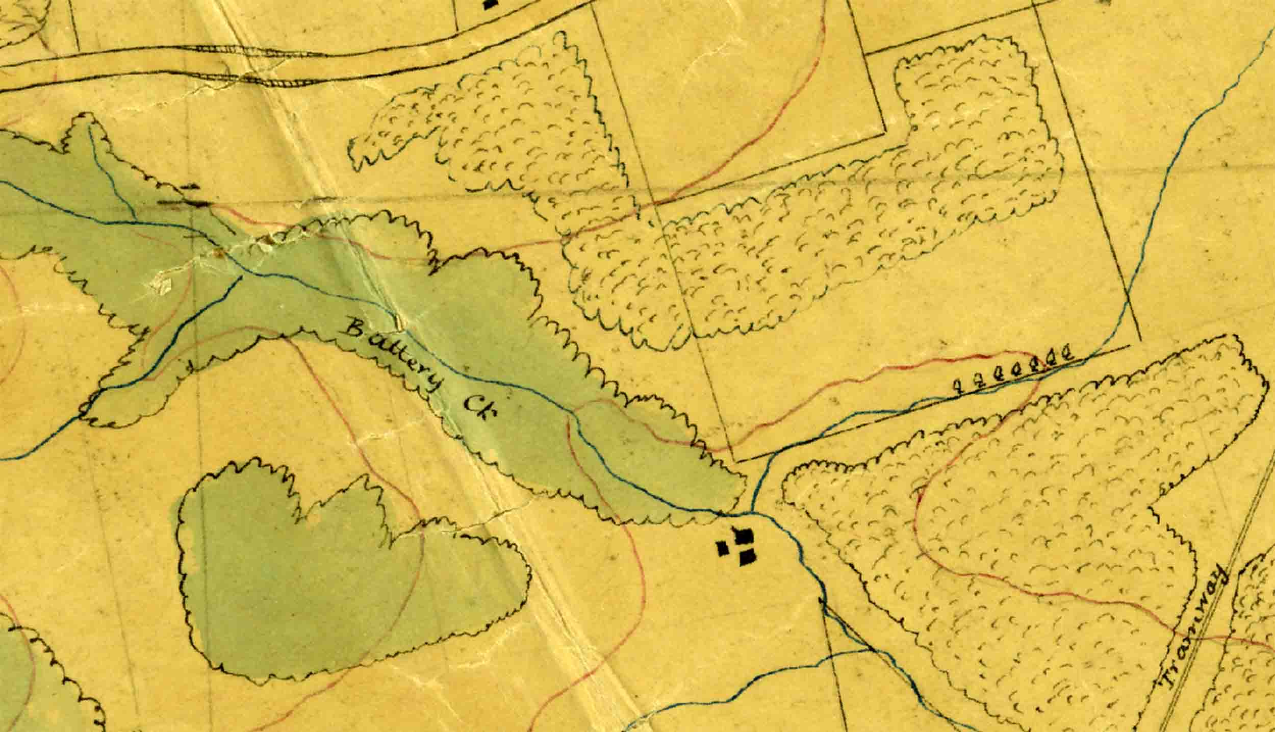
A portion of one of W.T. Neill’s maps showing a simple green-coloured patch an the left – interpreted as indigenous ‘bush/forest. To the north and east are patches that are uncoloured, but filled with stipple, and have been partially trimmed to property lines – interpreted as ‘ghost forest/bush’. This is in what is now the Fairfield area of Dunedin today, and has been cropped from: R23188990. Sheet No. 25 – Military Topographical Plan – Blocks VII and VIII Dunedin and East Taieri District – W T Neill, Surveyor (1907). Archives New Zealand Te Rua Mahara o te Kāwanatanga, Wellington. (CC BY 2.0).