
68
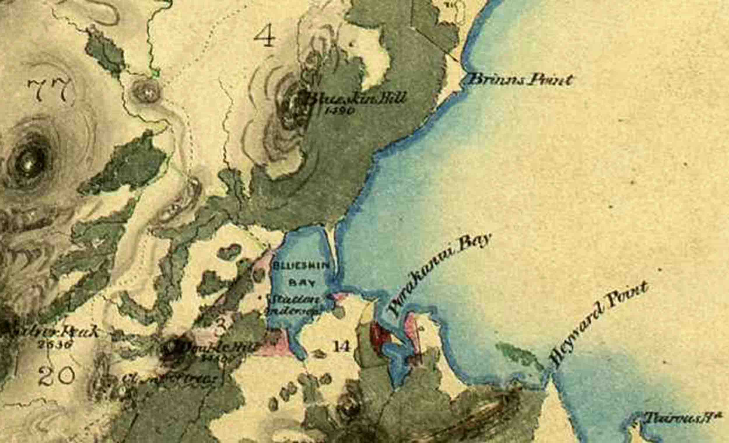
A portion of the ancient Maori footpath out of Otepoti-Dunedin shown (the dotted line to the left) on Thomson’s 1857 map. I have cropped this from: R10302722. ‘Reconnaissance Survey of Otago Province – North Eastern Districts’ – John Turnbull Thomson, Chief Surveyor (1857). Archives New Zealand Te Rua Mahara o te Kāwanatanga, Wellington. (CC BY 2.0).