
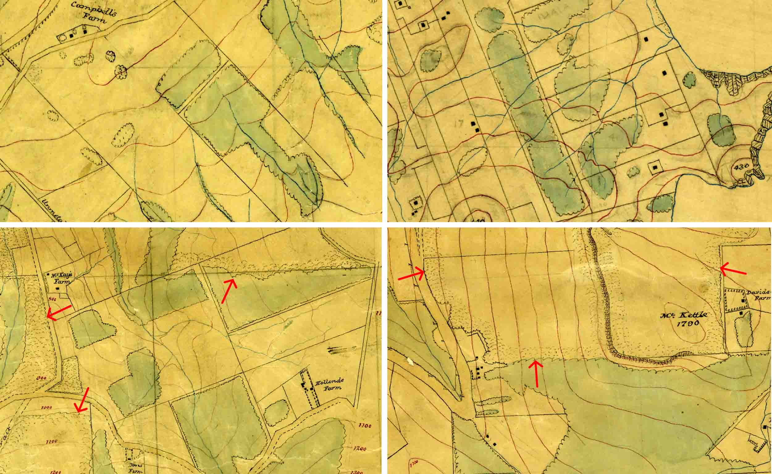
Four images from Neill’s maps (the buildings and roads give a general idea of scale).
Top left: Orokonui Ck-Mopanui. Bush areas (green) trimmed to property lines. Cropped from R22756747, Sheet No. 3 – Military Topographical Plan – Block I North Harbour and Blueskin District – W.T. Neill, Surveyor (1901). Archives New Zealand Te Rua Mahara o te Kāwanatanga, Wellington. (CC BY 2.0).
Top right: Otago Peninsula. Bush areas (green) trimmed to property lines. Cropped from R23188990, Sheet No. 20, Military Topographical Plan – Native Reserve Otago Heads – W.T. Neill, Surveyor (1901). Archives New Zealand Te Rua Mahara o te Kāwanatanga, Wellington. (CC BY 2.0).
Bottom left: Mopanui. Bush areas (green) trimmed to property lines, and arrows indicate the patches of adjacent ‘ghost’ forest with stipple pattern (uncoloured) around the outside. Cropped from R22756747, Sheet No. 3 – Military Topographical Plan – Block I North Harbour and Blueskin District – W.T. Neill, Surveyor (1901). Archives New Zealand Te Rua Mahara o te Kāwanatanga, Wellington. (CC BY 2.0).
Bottom right: Mount Kettle. Bush areas (green) trimmed to property lines, and arrows indicate the patches of adjacent ‘ghost’ forest with stipple pattern (uncoloured) around the outside. Cropped from R23190733, Sheet No. 7 – Military Topographical Plan – Block VII & XII North Harbour and Blueskin District – W.T. Neill, Surveyor (1901). Archives New Zealand Te Rua Mahara o te Kāwanatanga, Wellington. (CC BY 2.0).
